After introducing “Climate Intuition,” examining homeowners insurance and introducing broad climate adaptation strategies, we wanted to tackle a tangible asset to bring these issues of change, property risk and investment for resilience together. And with global trade in the news recently, we decided to focus on a key enabler—and bottleneck—of the supply chain: ports.
Ports are critical infrastructure worldwide, serving as a gateway to international and regional commerce.1 They will need to adapt under-projected sea level rise of up to 40 centimeters between 2020–50, risks of physical damage from extreme weather and climate, and changing maritime needs and trade dynamics. Necessary infrastructure upgrades and expansions will take capital. Otherwise, ports risk damage and resulting global trade disruptions, potentially threatening economic security.
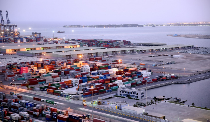
Why do ports matter financially and what goes into planning their size to handle trade volume? With economic globalization, ports have grown worldwide to handle the movement of seaborne trade from one country to another.
To size the scale of this today, in 2024 global trade was valued at $33 trillion with over 70% by value in maritime transport.2 The bulkiest items are transported by water; when measured by volume of goods, 80% of global trade is transported by sea. By volume, ~40% of all seaport transport is for fossil fuels (approximately half of that is for crude oil).3 Trade follows general routes determined by geography and trading partners through navigable waters.
Major routes have formed between continents with minor routes redistributing goods. Chokepoints form in areas with limited cost- effective alternatives where goods can be stalled due to ship traffic through narrow passages (straights/canals) or port capacity. These are known bottlenecks for trade—for example, the Panama and Suez canals, Cape of Good Hope and Strait of Malacca. These locations form critical trade infrastructure for refueling, ship repairs and swapping out containers and goods, circulating ships and keeping trade moving around the world. Note: We have not included river chokepoints, instead focusing on oceanic transport.
Maritime trade is expected to grow in coming decades, with estimates from the Organization for Economic Cooperation and Development of more than doubling by 2050.4 Ports will need to scale with trade. Engineering handbooks provide estimates of required annual port footprint (surface area required for a port) determined by containers moved, average number of days a container dwells at a location (how long it is at a location before leaving) and area required per container (determined by technology handling containers, ability to stack containers and various storage requirements).
Without proper planning and investment, port size can limit trade growth at specific locations, or move trade to ports with excess capacity altering routes. In an era of growing geopolitical risks and potential for maritime conflict, port infrastructure becomes more important to create predictable secure trade routes.
- Investment will be required to handle the expected increase in volume traded. Accordingly: Investment in the efficiency of containers (to lower # of days of dwelling) Technology to lower the area per container,6 and/or
- Building out hard infrastructure to expand ports footprint
Takeaway: Ports serve as a critical node in the movement of over 80% of the total volume of goods by sea worldwide. Maritime trade is expected to double by 2050, creating a need for investment in port infrastructure to handle growth.
What physical risks and related impacts do ports face from natural hazards and the ocean?
Natural hazards
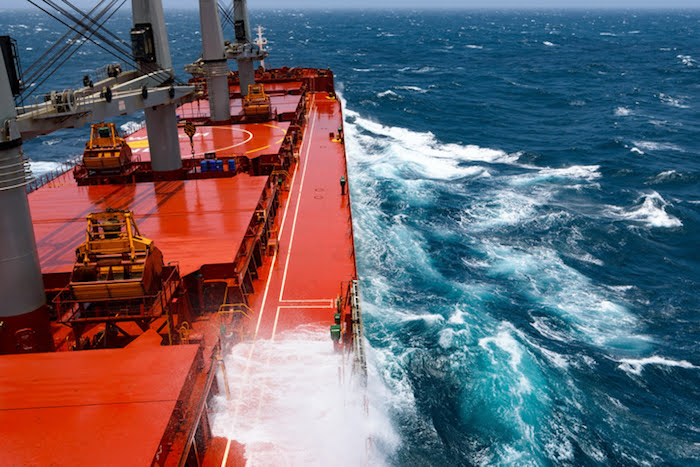
Ports are exposed to a variety of natural hazard risks, of high annual probabilities (hurricanes/typhoons,7 floods, droughts) and low probabilities (earthquakes) with present-day annual expected median value-at-risk estimated around $7.6 billion a year (range of $4.0–$17.4 billion).8 Breaking down these risks:
- 32% of the value at risk is due to hurricanes/typhoons, concentrated in the U.S. Gulf Coast region and Southeast Asia •80% of ports have annual exposure to flooding (saltwater coastal, rainfall, river), the most likely natural hazard
The tail risks for port damage includes events 10-100x annual losses, especially from hurricanes/typhoons or earthquakes. For example, Hurricane Ike caused $2.4 billion in damage to ports in Texas in 2008.9 Given the clustering of ports in the U.S. Gulf Coast and Southeast Asia, a single 300-mile-wide hurricane/typhoon can cause damage across multiple ports at once with wind damage, saltwater storm surge, and rain and riverine induced flooding.
The cascading effects of physical asset damage, port closures, trade disruptions and collocated high-value energy infrastructure could lead to multibillion-dollar loss events. For example, LNG terminals have been built up in these high hurricane risk zones in the U.S.
Sea level rise
Replacement locations for saltwater port infrastructure are limited—they have to be on the coast and at locations that easily access the water close to sea level (e.g., not on a high clitt). Existing port infrastructure depends on specific water levels.
Sea levels have been increasing historically for two reasons:
- Water expands with climate change. As the ocean warms, seawater undergoes “thermal expansion,” where a unit of water molecules takes up more volume. Depending on the time period, this is one-third or one-half of all sea level rise to date. •Glaciers are melting (more than freezing) as Earth’s surface warms. Ice on land is now melting more than it is accumulating, sending freshwater into the ocean as global temperatures have risen. This has accounted for two-thirds or one-half of all sea level rise to date.
Over the next few decades, these processes are expected to continue to raise sea levels and at a rate faster than in the past due to accumulated warming increasing glacier ice melt rates.10 Depending on geographic location, up to 40 centimeters of sea level rise are expected between 2020–50 worldwide. Below numbers are for median estimates of sea level rise under various emissions scenarios. The high range for 2100 has sea level rise of up to 2–7 meters if glacier melt accelerates.
While global sea levels have risen by 0.2 meters since the 19th century, 0.3–0.4 meters are expected by 2050 with broad geographic diversity. This increases the potential for floodwaters from hurricanes/typhoons and winter storms to inundate port infrastructure if resiliency planning does not take place (as the same storm produces more flooding under sea-level rise without adjustment of infrastructure to accommodate new sea levels). The total estimated investment required globally for port adaptation to sea-level rise is $223 billion to $768 billion by 2050.
Operational disruptions
Climate-related hazards can disrupt port operations while they occur, and for days and weeks afterward if damage requires repair. Worldwide, direct downtime risk from climate-related disruptions is currently a week or more (Figure 8). For context, costs of storm- related economic disruptions from hurricanes/typhoons have ranged from $10 million at the Port of Shanghai from 2012’s Typhoon Haikui to $65 million at the Port of Dalian from 2019’s Typhoon Lekima.
Takeaway: Ports have exposure to natural hazards and sea-level rise, requiring planning to alleviate impacts through downtime and damage. Adaptation to sea-level rise alone for existing infrastructure is estimated to require $223 billion to $768 billion by 2050.
What are port planning strategies for climate change?
Globally, mitigation planning has exceeded adaptation planning for ports. As discussed in Unlocking Resilience Through Climate Adaptation, global spending and strategic planning have favored climate mitigation (reducing greenhouse gas emissions) over climate adaptation. Disclosures of activities in major ports around the world follow this overall trend, with 89% of the largest ports (31 out of 35) developing mitigation plans whereas 66% of the largest ports (23 of 35) have developed adaptation plans.
As large infrastructure, ports have a multi-year planning and development phase (~decade) before a multi-decade useful life (50+ years). These long-term planning horizons require projecting future infrastructure needs. Besides projecting trade volume, they also have to account for changing physical exposures.
A port beginning planning phases today will be completed for use in the mid-2030s and will be in operation through the 2070s or longer. At these time scales, sea-level rise and changes to extreme weather and climate events are inevitable, and increasingly need to be planned for as their impacts are realized.
Decisions can be made between building for the projected future and/or creating capacity to allow for future spending to retrofit for future conditions if a port is expected to be used for its historic multi-decade lifetime. At a certain point, use of ports in specific locations may become difficult as saltwater overtakes land; ports may have to be moved. For example, in Indonesia, Jakarta is at risk of being underwater by 2050 due to water levels increasing by 3 to 5 meters caused by a combination of sea levels rising and land sinking. To prepare for this, they are already relocating infrastructure and the capital city to avoid disruptions during a future flood event or gradual coastal erosion.
The decisions aren’t just about (re)building hard infrastructure,16 but can include nature-based solutions for coastal resilience to create economic co-benefits from nature while also reducing erosion risk and damage by either emulating natural systems or restoring self-repairing ecosystem. These take the form of creating floodplains for storm water to collect and drain (saltwater or freshwater) or restoring ecosystems including wetlands, mangroves, corals and seagrasses. For example, in 2019 the Port of San Diego carefully laid out the economic value of natural systems to current port operations as well as the costs of nature-based adaptation strategies for handling sea-level rise to determine the price to build and long-term economic value created by such investments. The reasons for this are twofold: nature-based solutions can be used to improve resiliency when assessing extreme weather and climate exposure, and ports can operate across a wide region that requires the management of land and marine ecosystems, depending on location and local regulations.
Takeaway: Planning for climate change is underway worldwide, although adaptation planning lags behind decarbonization efforts. Some port locations with high exposure to sea-level rise are already making plans to move or significantly invest in infrastructure upgrades to adapt. Solutions to coastal issues may be nature-based, but may require life cycle analysis to capture economic benefits.
Case study: Galveston, Texas
To focus on how adaptation is being done in regions with known coastal flood risk, we have focused on Galveston. The Port of Galveston was established in 1825 as a trading post and is now municipally owned by the City of Galveston. It sits at the mouth of the Houston Ship Channel, the busiest waterway in the U.S. measured by waterborne tonnage.
Along the coast, high-tide flooding19 today can inundate barrier islands and inland, especially in low-lying Louisiana. The map shows where this can occur across the region.
Using high-tide flooding levels today as a threshold, projections of sea-level rise can be translated into changes in the number of high-tide flooding days.
Historically, there have only been a few (2–4) high-tide flooding days at the tide gauge at Galveston Pier 21. This year, 11–18 high-tide flooding days are predicted. By 2050, depending on the scenario of sea-level rise20 (bounded on low by a 2.7°C degree world and high by a 4.5°C world trajectories by 2100), the number of flood days at the current high-tide threshold is expected to increase by 12–25x. This requires flood management in low lying areas of the regional ports, building up infrastructure, and increases in direct downtime risk if flood alleviation measures are not implemented.
Noting flood risk after the costly damage from Hurricane Ike in 2008, a coastal barrier system plan was developed (the “Ike Dike”) to protect from hurricane storm surge and rising sea levels.21 It includes plans for replenishing natural barriers (e.g., sand dunes) and hard infrastructure (e.g., sea walls). The Port of Galveston mentions flood risk and the need for building these barriers in their 40-year development master plan in 2019.22 On May 28, 2025, Texas Gov. Greg Abbot signed House Bill 1089 to create a special account to manage the funds dedicated to build the Coastal Texas Project; Congress authorized the project in 2022, but it has not yet dedicated significant funding. The U.S. Army Corps of Engineers has projected it will take 20 years and $57 billion to construct the project; as of writing, it has not yet begun.
Takeaway: Coastal flood risks from storms and rising seas are known, but remediation can take decades. By 2050, Galveston’s port could be flooded a third of the year under a “low” sea-rise scenario, risking obsolescence. There is a choice today: Build for resilience or experience an erosion of usability and continued exposure to the next hurricane.
Other emerging issues for infrastructure design
Several factors beyond trade volume and physical risk will affect port development over the next decades. These are quick comments on issues that regularly come up in discussion of port infrastructure planning and investment.
Decarbonization of maritime operations
In April 2025, the International Maritime Organization, the 176-member state United Nations agency responsible for global shipping standards development, agreed to approve draft regulation decarbonizing the global maritime industry. This framework set mandatory fuel standards for ships to reduce greenhouse gas (GHG) emissions over time and established a GHG emissions pricing system for ships above a certain threshold. With trade volumes expected to rise, this will require emissions reductions at a time when investments are made to expand shipping. To do so, ports will have to accommodate new technologies. The two main infrastructure considerations are electrification of port infrastructure and bunkering of new fuels.
Electrification is already underway, driven by a desire to improve in-port air pollution given the majority of ports are near major cities. When ships sit in port, without electrification they have to rely on burning fuels to maintain in-port ship operations, contributing to smog, urban ozone and sulfur particles.24 Further electrification infrastructure (and grid capacity) is required for ports to go fully electric. For example, the Port of London Authority has released a roadmap to 2050 for electrification of operations.25 Working with utilities and other groups, it has recently unveiled its implementation through the Electric Thames initiative to develop infrastructure planning for changing river flows and electrification.
Changes to shipping fuels will also require port infrastructure planning and investment. Hydrogen is explosive and may act as a greenhouse gas when it leaks.27 Ammonia is an environmentally damaging chemical if released; leaks into water contribute to nitrogen pollution, which leads to dead zones, red tides and harm to aquatic life. Even under the best circumstances, bunkered fuel can leak due to equipment failure, accidents, storm damage and earthquakes. The use of small modular reactors for long-range maritime transport (or port electrification) will also require risk considerations when collocated. To be clear, current shipping fossil- based fuels also leak and contaminate fisheries and freshwater aquifers. Either way, expanding shipping and shipping fuel bunkering requires additional port infrastructure and risk management.
Speed of decarbonization of global energy (moving carbon)
The future of fossil fuels will affect projections of global trade. Presently, ~40% of the volume of global trade is fossil fuels. Shifts in the amount of fossil fuel use in energy, chemicals and plastics can dampen projected trade predictions. Academic studies project a 2x to 4x need for port area with maximum growth under scenarios where fossil fuel demand continues to grow and requires shipment coupled with high demand for other commodities. Even with decarbonization of the global economy and suppressed commodities demands, port size is expected to double.
Geopolitical uncertainty
Geopolitics can halt the shipping of goods between countries and worldwide. For example, in recent years container ships have been delayed reaching the U.S. when stuck in Chinese ports due to two major incidents
These container volume shocks typically have been short lived and rebounded after being resolved. However, they stress the entire system as containers stalling at a location instead of moving to the next port or inland (technically referred to as “dwelling,” port size from Formula 1) limits port capacity to accept new containers. Geopolitical uncertainty can require additional port infrastructure to handle dwelling variability.
The national security of ports
As transportation hubs in global supply chains, ports must operate reliably to protect, predict and manage commerce. The chokepoints highlighted in Figure 2, defined by geographic barriers limiting the travel of goods, are key locations for trade. Maintaining access and reliability of certain ports may play a strategic role for countries to secure trade routes and specific supply chains.
An ice-free Arctic
Finding a Northwest Passage to avoid running around the Americas has been a goal of explorers (many with crews who mutinied when frozen in place) since the 1600s. The realities of year-round freezing temperatures have left Arctic waters covered in permanent flows of sea ice. However, projections of climate show that by the 2040s, the Arctic Ocean is likely to have days where it is “ice free.” This does not mean the Arctic will be free of sea ice year-round, however, only that it will first have days of open water in late summer, with expected re-icing by winter.
The extent of sea ice follows the season, with a minimum reached in September after months of full sunlight hours and a maximum reached in March. For perspective, you can look down at Earth from the North Pole at the center, showing Arctic Sea surface temperature is still below freezing in September, despite its being the warmest point in the year.
Opening of Arctic waters will allow for new trade routes (e.g., Europe or eastern U.S. to Asia, Russia to Asia via Arctic and Pacific) during a very narrow window of the year. This is a multi-decade consideration for port growth and trade routes, but it will be seasonally limited.
Takeaway: Decarbonization of the global economy and marine transportation will affect port planning and infrastructure of the future. This transition risk makes it difficult to know exactly how to plan today for a port’s +50-year useful life, highlighting the need for flexible design and planning as technologies and preferences develop. Geopolitical uncertainty, both in trading partners and Arctic control, will also affect future trade routes, shifting port demand and potentially northward during specific seasons for Arctic shipping.
Conclusions
Ports remain critical nodes in the international supply chain, facilitating the movement of goods and underpinning economic security. The anticipated doubling of maritime trade by 2050 necessitates substantial infrastructure upgrades to accommodate increased volumes. Ports face risks from extreme weather and climate-related disruptions, with potential damage threatening infrastructure and commerce. This requires a multifaceted approach as capital is deployed—enhancing technological efficiencies, expanding infrastructure and reducing physical risks.
Adaptation planning, while increasingly needed in respaonse to growing physical exposure, lags behind mitigation efforts, underscoring the need for a balanced strategy that addresses both regulatory requirements for decarbonization and long-term climate impacts. Estimates suggest a global requirement of $223 billion to $768 billion by 2050 for sea-level rise adaptation alone. Given the price estimates of coastal resilience upgrades for the Coastal Texas Project ($57 billion), this number climbs higher when also accounting for extreme storms.
Without strategic planning to ensure trade operability and capacity, ports face the risk of future obsolescence.
Source: JP Morgan