At a Glance
- Undersea cables and offshore pipelines have become primary targets for covert state-linked activity and gray-zone pressure.
- Infrastructure sabotage is accelerating, from Baltic Sea incidents to suspicious cable cuts and dual-use fishing vessels.
- Traditional maritime intelligence tools cannot detect threats masked by AIS manipulation or disguised as commercial activity.
- Protecting critical maritime infrastructure requires persistent, multi-sensor visibility – SAR, EO, RF, AIS truth analysis, and behavioral analytics.
- Remote Sensing Intelligence provides independent detection when AIS is silent or falsified, making it central to undersea cable security.
- Windward’s Critical Maritime Infrastructure Protection fuses sensors, ownership intelligence, and behavioral models to detect pre-operational risk early enough to intervene.
Critical maritime infrastructure includes the systems that keep nations connected and economies functioning, including undersea cables, offshore pipelines, subsea energy networks, LNG terminals, and coastal power links. These assets carry 99% of global data exchanges, enable international financial flows, and support national energy security. They are also almost entirely hidden from public awareness and difficult to defend given their scale, depth, and geographic spread.
This is exactly what makes them attractive targets.
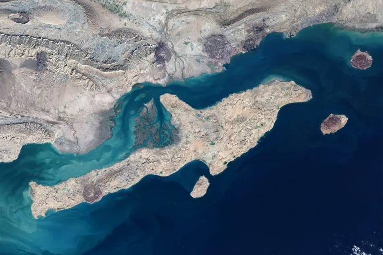
Undersea cables stretch across 1.7 million kilometers of ocean, often lying in shallow or lightly monitored areas where vessels can approach without raising suspicion. Pipelines, offshore platforms, and energy connectors face similar risks, as they remain exposed, difficult to surveil continuously, and easily accessed under the cover of routine maritime operations.
Recent incidents in the Baltic Sea, including damage to the Sweden-Estonia subsea cable and suspected state-linked activity near European subsea networks, show how vulnerable these systems are to interference. The 2023 Matsu incident in Taiwan demonstrated the real-world consequences: after two Chinese vessels severed both cables serving the islands, 13,000 residents were left with almost no internet for 50 days. Banking slowed to a crawl, online services collapsed, and even emergency communications were degraded, all without a single explosive device or overt act of aggression. It remains one of the clearest examples of how undersea cable disruption can create a strategic crisis under the guise of an accident.
For governments, the threat is multiplied not only by the vast scale of undersea infrastructure, but by the fact that any damage can appear as an accident, leaving no clear culprit and no accountability. A vessel dragging an anchor or “fishing gear entanglement” can mask deliberate probing or sabotage, giving state-backed actors plausible deniability while leaving governments to manage the fallout.
A vessel can loiter over a cable for hours while appearing perfectly compliant on AIS. Fishing fleets can perform “routine” slow-speed maneuvers that double as surveillance. Location (GNSS) manipulation can mask proximity to infrastructure entirely. These behaviors look normal unless governments have the Remote Sensing Intelligence, behavioral analytics, and multi-sensor visibility needed to reveal intent.
In a world where undersea cable security directly affects national security, economic resilience, and strategic stability, maritime intelligence must evolve from monitoring traffic to protecting infrastructure.
The Surge in Sabotage: From the Baltic Sea to Global Cable Cuts
Over the past few years, critical maritime infrastructure has become a prime target for gray-zone activity, with undersea cables and offshore networks experiencing a rise in suspicious incidents across Europe and beyond. In the Baltic Sea, damage to connectors between Sweden, Estonia, and Finland triggered multiple national investigations, each pointing to questionable vessel movements and the possibility of state-supported interference. Elsewhere, unexplained cuts in global cable routes, including the Mediterranean and Red Sea, have raised similar concerns.
What ties these events together is the behavior behind them. Vessels are showing patterns that resemble pre-operational surveillance: long loitering windows directly above cable routes, slow-speed passes along infrastructure corridors, repeated returns to the same points, and identity or AIS inconsistencies designed to obscure proximity.
The activity of several Russian-linked fishing and cargo vessels illustrates how this unfolds in practice. Investigations into fleets tied to Murman Seafood and the Norebo Group – already sanctioned or flagged for dual-use concerns – revealed repeated slow-speed operations over Scandinavian and North Atlantic cable networks, unjustified course deviations, and opaque ownership links connecting multiple vessels to the same operators. Each incident alone could appear benign, but together, they form a coordinated pattern of infrastructure-focused behavior.
These cases reflect a broader shift: adversaries are exploiting commercially plausible vessels to conduct surveillance or prepare for infrastructure sabotage, making attribution harder and timelines shorter. The threat grows because the activity blends seamlessly into normal maritime traffic unless governments have the multi-sensor intelligence needed to expose intent.
Why Monitoring Undersea Cables Is So Difficult
Protecting undersea cables is uniquely challenging because the activity that threatens them looks almost identical to the activity that surrounds them every day. These routes sit beneath busy fishing grounds, cargo corridors, and service lanes, which means a vessel can position itself directly above critical infrastructure without triggering suspicion. Even deliberate reconnaissance can mimic routine operations, as slow-speed passes resemble trawling, drifting looks like weather influence, and anchor drops can be dismissed as “incidental.”
Traditional monitoring relies on cooperation, but actors targeting critical maritime infrastructure don’t need AIS silence to hide. They simply need to blend into the noise.
This is exactly what recent Russian-linked fleets demonstrated. Their activity blended into ordinary maritime patterns, making it nearly impossible to distinguish benign movement from pre-operational behavior:
- Slow-speed passes that resemble trawling, but trace perfectly along mapped cable corridors.
- Extended pauses above subsea networks, framed as drifting, gear checks, or weather delays.
- Repeated returns to the same coordinates weeks apart are consistent with pre-operational mapping, not fishing cycles.
- Minor deviations on AIS that position vessels directly over high-value cable routes.
- Ownership links between seemingly unrelated vessels, exposing coordinated activity only visible through Visual Link Analysis.
- Compliance-clean AIS tracks with no dark activity and no gaps, masking behavior that is later proved to be high-risk.
What Governments Need to Protect Critical Maritime Infrastructure
Protecting undersea cables, pipelines, subsea energy networks, and offshore platforms requires visibility equal to the scale and subtlety of the threats targeting them. With millions of kilometers of undersea cables and thousands of kilometers of pipelines crossing high-traffic waters, governments cannot rely on patrols, cooperative AIS signals, or sporadic satellite imagery. The environment is simply too vast, too busy, and too easily exploited.
Threat actors understand this.
They blend reconnaissance into normal maritime noise that obscures coordination. These tactics work because they exploit the blind spots in traditional surveillance models.
To overcome these blind spots at scale, governments need a multi-sensor intelligence framework that fuses independent detections, behavioral context, ownership truth, and network-level visibility into one operational picture.
Why Multi-Sensor Fusion Solves the Scale Problem
No single source can protect critical maritime infrastructure on its own. But when these layers are fused, governments gain:
- Independent visibility across vast maritime regions where threats hide in plain sight.
- Persistent monitoring that does not depend on cooperative broadcasts or patrol proximity.
- Signal clarity that cuts through fishing traffic, cargo lanes, and seasonal noise.
- Early detection of reconnaissance behaviors long before damage occurs.
- Actionable attribution, because identity, behavior, and ownership align into one coherent picture.
The Role of Alliances and Joint Maritime Security
Protecting critical maritime infrastructure is bigger than any single nation. Undersea cables, pipelines, and offshore energy links cross borders, and the tactics used to probe or sabotage them operate the same way. This is why regional alliances are rapidly becoming the backbone of infrastructure security.
NATO, the Joint Expeditionary Force (JEF), and Baltic-Nordic partners are now coordinating surveillance, intelligence sharing, and response around the regions most at risk. The Sweden-Estonia connector incident and similar activity in the North Atlantic accelerated these efforts, pushing governments to move from isolated monitoring to shared situational awareness.
Across all these alliances, the need is the same: sensor coverage that spans jurisdictions, behavioral models that speak a common language, and intelligence that can reveal network-based threats early enough to act.
This is the direction critical maritime infrastructure protection is moving – collective, multi-sensor, and intelligence-driven.
Windward’s Critical Maritime Infrastructure Protection
Critical maritime infrastructure cannot be safeguarded with AIS alone, and it cannot be protected with siloed detections, delayed reporting, or manual investigation. What governments need is a fused, sensor-agnostic intelligence environment. Windward delivers that foundation.
Windward’s Critical Maritime Infrastructure Protection combines Remote Sensing Intelligence, behavioral analytics, and ownership intelligence into one operational picture that can reveal threats long before they escalate. SAR, EO, and RF supply independent detections; Maritime AI™ correlates them with AIS truth analysis, pattern-of-life modeling, and network-level insights; and MAI Expert™ translates complex activity into clear, decision-ready intelligence.
This is the difference in the infrastructure context: Windward doesn’t just show vessels – it shows intent, networks, and pre-operational behavior, enabling agencies to distinguish legitimate movement from infrastructure-focused activity across vast regions.
With a single fused picture that scales across borders, jurisdictions, and intelligence partners, governments can finally monitor not just traffic, but the activity beneath it that determines whether cables, pipelines, and offshore assets stay secure. Source: Windward